Organizer

-
Marc and Mardi Lavertu
-
Phone
(760) 413-4709 -
Email
mlavertu@shaw.ca -
Mardi and Marc enjoy hiking in the coastal rain forests near their home on the Sunshine Coast in British Columbia but since retiring in 2013 they now happily spend winters exploring by foot the desert and surrounding mountains of the Coachella Valley. They also love to visit France where they have done a number of long distance hiking excursions in recent years. An avid outrigger canoe paddler, Marc is always in search of interesting places to paddle---a challenge in the desert!
SOUTH FORK OF THE PACIFIC CREST TRAIL – CANCELLED
*** This hike is cancelled due to the high temperatures. ***
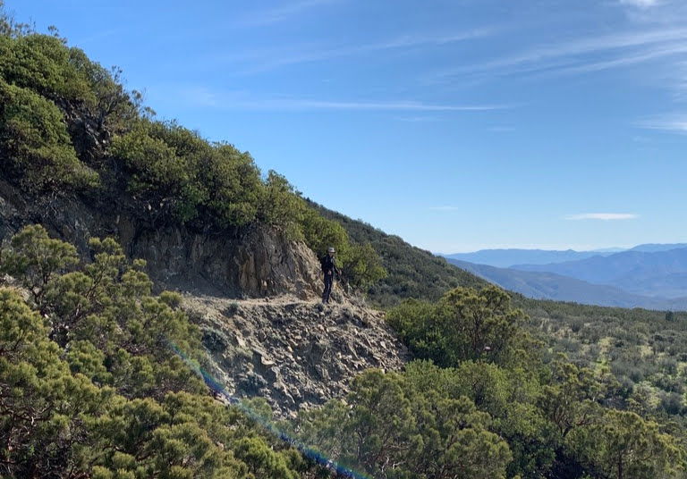
The South Fork is a section of the Pacific Crest Trail (PCT) heading south toward Mexico from where it crosses Highway 74. The trail first takes you through sage and low brush, up a mountainside and along a low ridge. From here you can see to the north a vista of San Jacinto Mountain. The trail swings alongside the mountain and eventually you pass a steep canyon network that marks the northern watershed for the Anza-Borrego Desert, 20 miles to the southeast. You will glimpse row after row of distant mountain ranges. Passing through a flat meadow area, the trail begins a series of down-and-up wash crossings and hill climbs. To the east, you will have a good view of Santa Rosa Mountains’ southwestern flank. Our lunch spot and turn around point overlooks the Anza Valley. If we are lucky, we might see some California poppies.
Distance: 11 miles
Elevation Gain: 1282 feet
Pace: 1.5-2.0 miles per hour (medium)
Time: 5.5-6.0 hours
Group size limit: 10 hikers maximum
If you have hiked with Marc and Mardi before, please email them with any questions and to request participation in the hike. If you haven’t hiked with them before, please call. They may ask about your recent hikes.
HIKE LEADERS: Marc and Mardi Lavertu
HIKE LOCATOR: Mountain Center
HIKE DIFFICULTY: Strenuous
HIKE PACE: Medium
Note: You must be a current CVHC member to hike with the club! Join Now!
