Organizer

-
Jeff Guckenberger
-
Phone
541-954-1531 -
Email
jguck61@gmail.com -
Jeff and his wife have been visitors to the desert for the last 30 years and more recently wintered in Palm Desert for the last seven years. Our summer home is in Eugene, Oregon. Jeff has been mountain biking the Western states for 30 years, backpacking the John Muir Trail and sections of the Pacific Crest Trail more recently. You will find me hiking the Coachella Valley on a weekly basis during the winter months. Jeff prefers more strenuous and challenging hikes with the hope of seeing wildlife and marveling at the incredible beauty of the Coachella Valley.
CEDAR CREEK SPRING TRAIL (TOWARD IDYLLWILD)
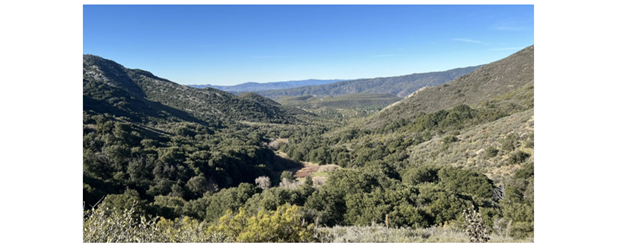
Join Jeff to enjoy cool alpine weather, amazing views and some interesting interactions with long-distance hikers on the PCT — plus a lunch break at Cedar Spring, an amazing location with ice-cold spring water flowing into a trough, nestled below large shade trees. The route for this hike follows a loop using sections of Cedar Spring Trail, the Pacific Crest Tail (PCT) near Hwy 74, and Eagle Spring Trail.
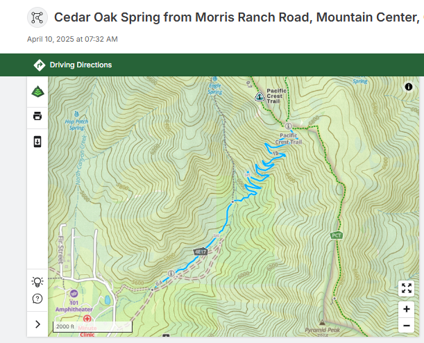
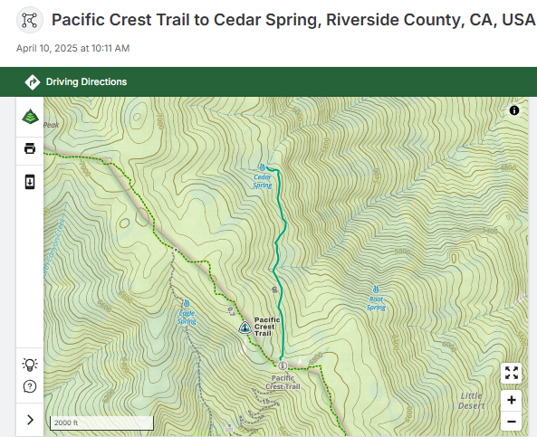
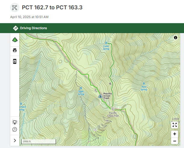
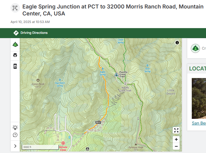
The hike starts at 8 AM, at the southern terminus of Cedar Spring Trail, about a 1 hour drive from Palm Desert. From here, we ascend Cedar Spring Trail until it meets the Pacific Crest Trail (PCT), at 6800’ elevation. We cross the PCT and proceed 1 mile downhill to Cedar Spring. This is a very popular water resupply location as well as a place for PCT travelers to camp. Jeff will bring a water filter so participants can refill their water containers. After a brief break, we turn around and hike back up the trail to the PCT. We then head up the PCT for approximately 3/4 mile to the intersection with Eagle Spring Trail Junction. At this point, we head down Eagle Spring Trail to its intersection with Cedar Spring Trail and finally, follow Cedar Spring back to the starting point for a total hike distance of 6.14 miles and 1948′ elevation gain.
Since long-distance PCT hikers are moving through this area now, we have the opportunity to share some trail magic. Participants are invited to bring a gallon of water to leave at the intersection of the PCT and Cedar Springs trail. That is to say, participants would carry extra water up the first pitch of the route (2.04 miles and 1254 feet of elevation gain) before offloading the water at the trail intersection. The donated water will save long-distance hikers a 2 mile off-trail trip to resupply water. Of course, bringing extra water is voluntary and if participants aren’t comfortable carrying that additional weight that’s perfectly OK and understandable. Please don’t feel obligated.
Participants who would like to carpool should meet at 7:05 AM at St. Margaret’s Episcopal Church, 47535 Hwy 74, Palm Desert. Car pools will be organized there.
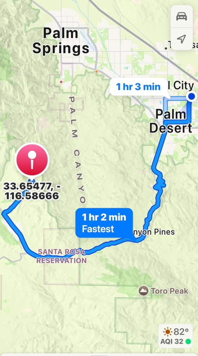
Participants who want to drive themselves should meet at 8:00 AM at Cedar Springs Trail, GPS coordinates: 33.65477, -116.58666. (Refer to the attached Google Map which shows the hike start point. Enter the GPS coordinates into a mapping program to get detailed driving directions.) Participants who will drive themselves to the trail and are starting from Palm Desert will follow Hwy 74 over the mountains, past Pinyon Pines and the Hwy 371 turnoff, to Morris Ranch Road. Take a right onto Morris Ranch Road and follow it almost to the end, to the intersection with Pathfinder Road. Turn right onto Pathfinder Road and follow it for less than 1 mile to the end of the road and the Cedar Spring trailhead.
Please don’t hesitate to contact Jeff with any questions(541-954-1531).
Distance: 6.14 miles
Pace: Medium/fast
IF THIS IS YOUR FIRST TIME HIKING WITH JEFF, PLEASE CALL OR TEXT (541-954-1531.). OTHERWISE, PLEASE EMAIL.
Note: You must be a current CVHC member to hike with the club! Join Now!