Organizer
-
Duane Pellervo
-
Phone
415-717-6410 -
Email
dpellervo@gmail.com -
Duane and his wife, Pat, moved to Rancho Mirage in 2020 and are full time residents of the desert, although they also have a small place on Monterey Bay for when it gets insanely hot here. Since moving to the desert, hiking has displaced cycling as Duane’s exercise of choice, and he's been an enthusiastic member of CVHC since 2023. As a full time resident, Duane really appreciates the ability to participate in club hikes not only during the cooler months but also, at appropriate elevations, during the summer as well.

TAHQUITZ PEAK OUT AND BACK FROM HUMBER PARK TRAILHEAD
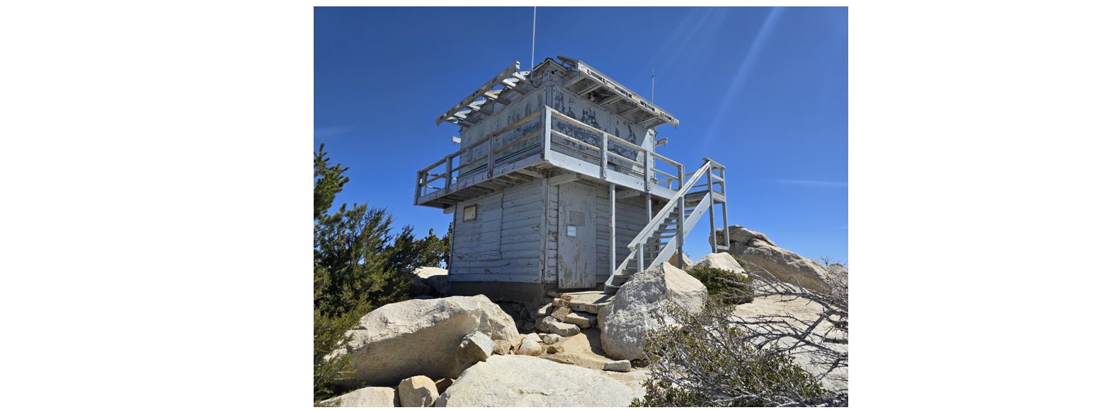
On this hike we travel from the Humber Park Trailhead (elevation approximately 6,500 feet) to the top of Tahquitz Peak (elevation 8,846 feet), the location of the historic Tahquitz Peak Fire Lookout. The Lookout was built in 1937 and is the highest lookout tower in the San Bernardino National Forest. It’s still in use and if we’re lucky it will be open when we’re there. On a recent club hike led by Andrew, the Lookout was open and the volunteers there invited us inside, where we learned how the eponymous Osborne Fire Finder (pic attached; invented in 1911 by William B. Osborne of the U.S. Forest Service) is still used to pinpoint the exact location—azimuth and distance–of a wildfire.
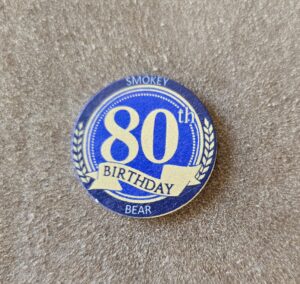
On a prior visit I was humbled to be awarded a Smokey the Bear button commemorating Smokey’s 80th birthday….
But I digress. This hike is about 8.8 miles long with a total elevation gain of about 2,360 feet. We climb steadily right from the trailhead along the Devil’s Slide Trail for 2.5 miles until we reach Saddle Junction, a very pleasant park-like setting where we will take a break (in addition to prior breaks as needed). You often see thru-hikers on the PCT here. Leaving Saddle Junction the terrain initially is relatively flat but gets progressively steeper (with a bit of rock scrambling) over the remaining 1.9 miles to the top of Tahquitz Peak. If you have issues with heights, please be aware that there are a few steep drop-offs along the trail, particularly as we near the summit, After a lunch break at the summit we will return to the trailhead the same way we came.
There are no reliable water sources this time of year and it can get hot even at these higher altitudes, so in addition to snacks and lunch please bring plenty of water.
We will begin the hike at 8:30 a.m. at the Humber Park Trailhead. We should get back to the Humber Park parking lot by about 2 p.m.. The anticipated pace of this hike is about 2.2 mph on average, but given the relatively high altitutde of this hike and the total elevation gain it should be considered a strenuous hike.
I will have a hiking permit covering all of us but you will need a parking permit to park at Humber Park. These can be obtained for $5 at the San Jacinto Ranger Station in Idyllwild (54270 Pine Crest, Idyllwild), which opens at 8 am Thursday through Monday (it is closed on Tuesday and Wednesday). If you have an equivalent Interagency Pass, such as an America the Beautiful or National Parks Pass), you can use that to park.
Please email Duane at dpellervo@gmail.com to sign up for this hike and include your phone number. If this is your first time hiking with Duane, please include a description of your hiking experience and current fitness level.
Trip details:
- Hike locator: Humber Park, Idyllwild https://maps.app.goo.gl/3vU7LtyipYnaECpc6?g_st=am
- Total elevation gain: 2360 feet
- Distance: 8.8 miles
- Pace: 2.2 mph on average, which may feel fast considering altitude and elevation gain
- Terrain: Packed trail, some rocks
- Obstacles: Nothing significant
- Difficulty rating: Strenuous
- Maximum # of Hikers: Six
- Hike date, time: Monday, June 22, 2026, 8:30 am. – 2 pm
Note: You must be a current CVHC member to hike with the club! Join Now!